
{Edinburgh} Family Walk Around Torduff Reservoir
As I’ve said before, one thing I love about living in Edinburgh is how close we are to nature and lots of great walks, such as the Hermitage of Braid or Buckstone Woods & Seven Acre Park. A bit further afield are the Pentland Hills, which I see every day from my home office window. I’ve been wanting to get the family our there for ages, but we always end up picking somewhere closer to home. Even though it’s more of a distance, you can actually get to several of the Pentland Hills walks by bus, and at the start of the year I finally managed to get us all out there for a walk around the Torduff Reservoir at Bonaly Country Park.
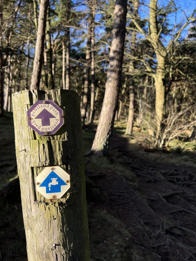
The No 10 Lothian Bus stops within walking distance of the route, which is marked out as “Torduff Water Walk” (the route signs show an image of a tap). I’ve made a map to show the route we took – marked in purple – and I’ve added some markers too whenever there’s a junction in the path.
Route Description
This is the route for the circular “Torduff Water Walk” through Bonaly Country Park and around Torduff Reservoir. The route described on the map goes around the route clockwise (you can of course also walk the route the other way round).
Starting Point: Bonaly Country Park Entrance –
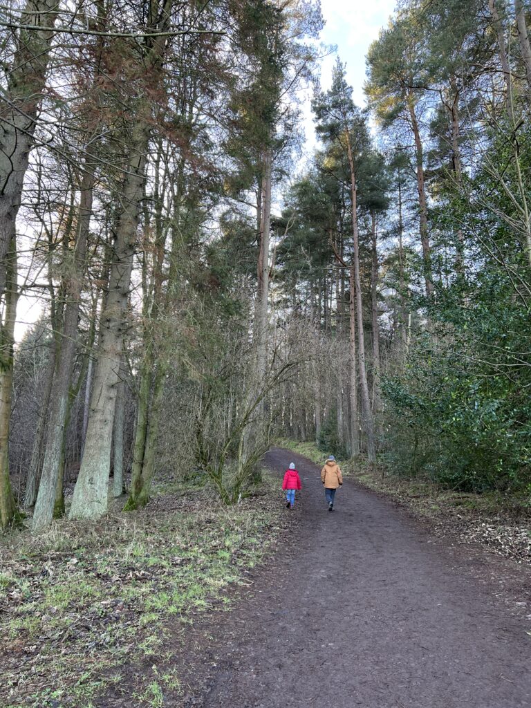
Enter through the gates, and go straight ahead uphill in to the woods.
Circular Route Junction 1 –
When you reach the gate at the other side of the woods, don’t go through the gate, turn right before the gate. There’s a sign post pointing towards Torduff Reservoir/ Torduff Water Walk, and a waymarker with the Torduff Water Walk symbol. Keep to the left and walk along the edge of the woods – there are a lot of exposed roots, so mind you don’t trip.
Circular Route Junction 2 –
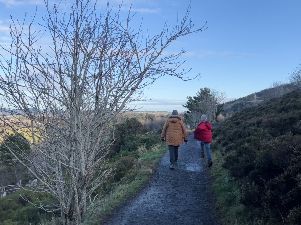
When you exit the gate at the end of the woods, keep to the path on the left. Stay on this path. There’s some rough terrain, so be careful.
Circular Route Junction 3 –
At this junction, you exit from the walking path back on to Torduff Road. If you go straight ahead and then turn right, this continues the circular route around the reservoir. Or, for a detour to the Coffee Stop, turn left (there’s a sign pointing towards it).
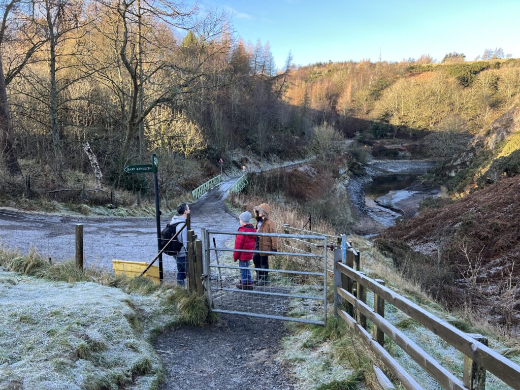
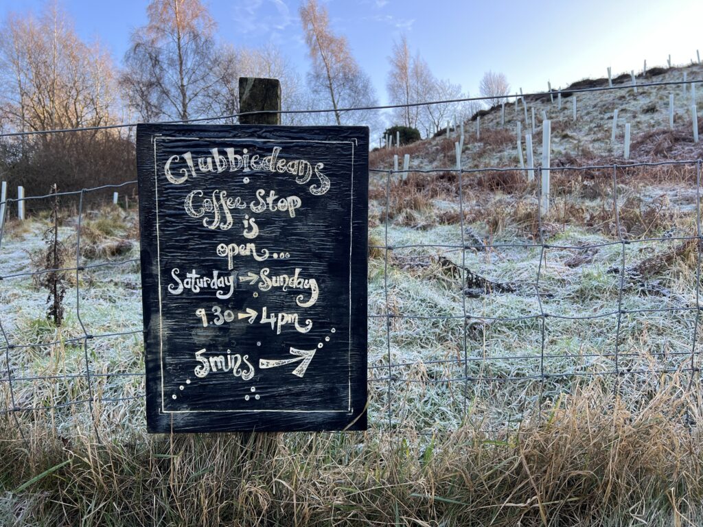
Detour: Clubbiedean’s Coffee Stop –
The Coffee Stop is open on Saturdays and Sundays. They have tea, coffee, hot chocolate, soft drinks, cakes & scones, and soup (Note there are no public toilets). Retrace your steps to Junction 3 to continue the circular walk.
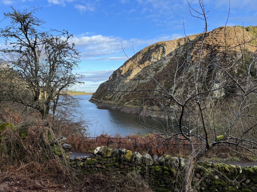
Circular Route Junction 4 –
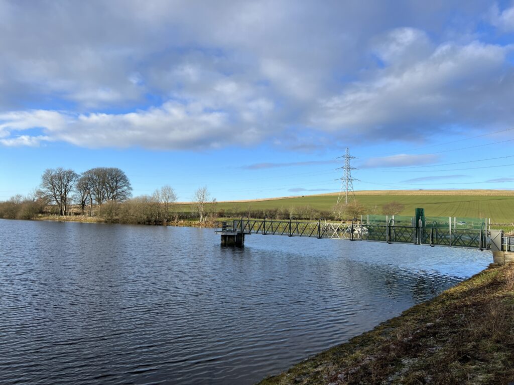
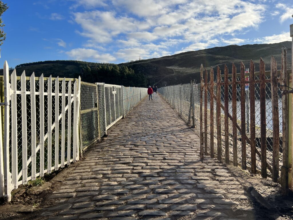
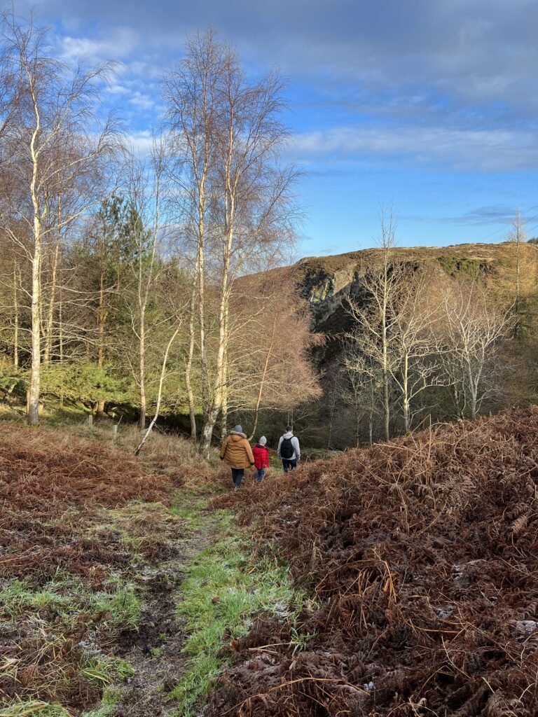
At the end of the reservoir, turn right, walk across the reservoir dam and take the path up the hill. Stick to the main path. It will take you back to where you started.
NOTE: We haven’t tried this out ourselves yet, but for an extended walk (no luck convincing my kids to do this!), take the detour to Clubbiedean’s Coffee Stop and from there take the circular route around the neighbouring Clubbiedean Reservoir. Then rejoin the Torduff Reservoir at Junction 3 on the map.
Alternative Route
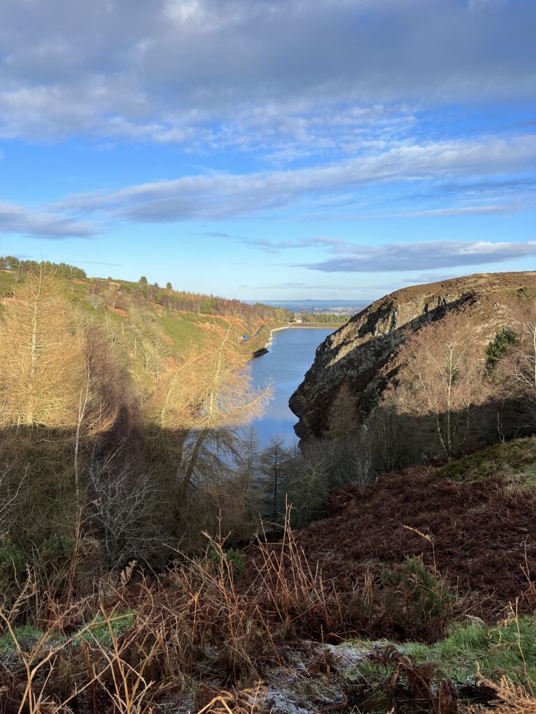
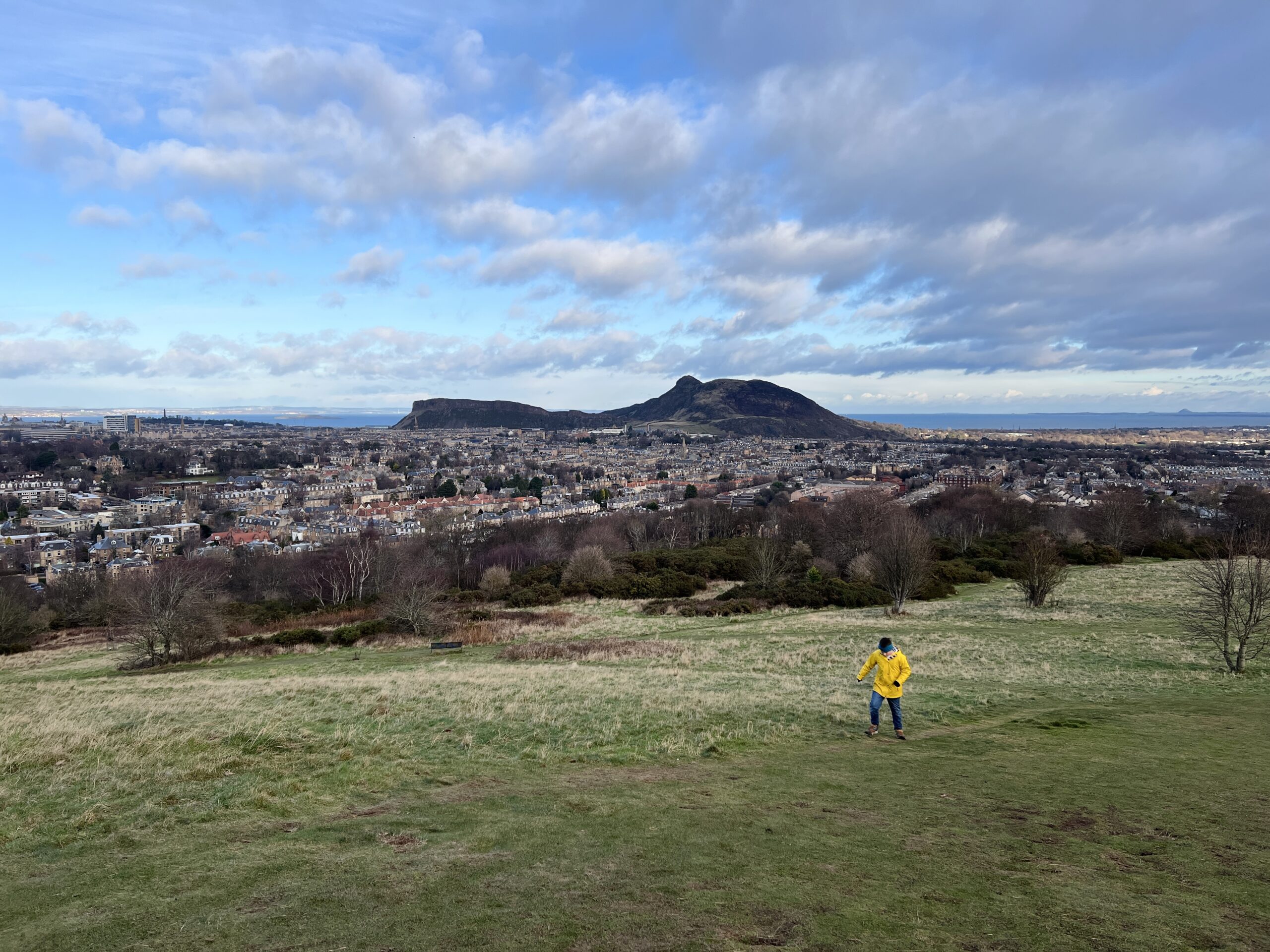
If you’ve stopped off at Clubbiedean Reservoir, instead of backtracking to Junction 3 on the map, there is an alternative route from there to rejoin the Torduff circular walk, marked in yellow. This is the route we actually took on the day. The first part goes around fields and is fairly flat, the second part through the trees is a steep path going downhill, fairly rough underfoot. The views were amazing, but in hindsight, I wish we had backtracked instead. In January, it was icy and wet and very slippy, the kids were fairly sure underfoot but I almost fell a couple of times. Might be better in dry weather, or if you don’t mind some bum shuffling on the way down, but maybe best kept for the very adventurous (which isn’t me…)
How long does it take?
The circular route, starting from the entrance to Bonaly Country Park, took us around 2 hrs which included stopping for a packed lunch at Clubbiedean Reservoir/ Coffee Stop. If you are arriving by bus, you will also need to add on the time to walk to and from the bus stop, which takes around 15 minutes each way.
How to Get There
By Car:
If arriving by car, there is a car park at the entrance to Bonaly Country Park.
By Bus:
The closest bus stop is Bonaly Terminus, serviced by Lothian Bus 10.
From the bus stop, retrace your steps to Bonaly Road. Walk up Bonaly Road towards the hills, across the by-pass, and past the Scout Camp and BobCat Alpacas until you get to the car park (beware of passing cars!), where you will find the entrance to Bonaly Country Park.
Good to know: Between the Scout Centre and the car park, there’s a foot path running parallel to the road.
For Your Phone
Open this map on your phone >> OPEN MAP
Pingback: Easter Holidays 2025 – Free Family Activities in Edinburgh – The Bear & The Fox
Pingback: Summer Holidays 2025 – Free Family Activities in Edinburgh – The Bear & The Fox
Pingback: Christmas Holiday Activities in Edinburgh 2025/26 – The Bear & The Fox